When Google Earth was released in 2005, I thought that it would be interesting to see if I could locate all the places that I lived over the past 50 years (1955-2005). I collected snapshots of satellite pictures of the places that I resided and schools that I attended as a kid. Six years later I finally got around to putting it all together in a presentation that documents these shots. In each of the shots, the pictures are oriented facing the front of the structure. On most of the pictures, there is a compass rose showing the orientation of the map.
This covers the years 1977 to 1981. This was a time of transition for me. I traveled cross-country from Texas to Florida, Florida to Georgia, and then in the summer of 1977, I drove from Fort Gordon, GA to Fort Lewis, WA via Houston for a total of 3,333 miles. Then at the end of 1978, I traveled another 3,000 miles to Osan Airbase, Korea.
West Palm Beach, Florida (1977)
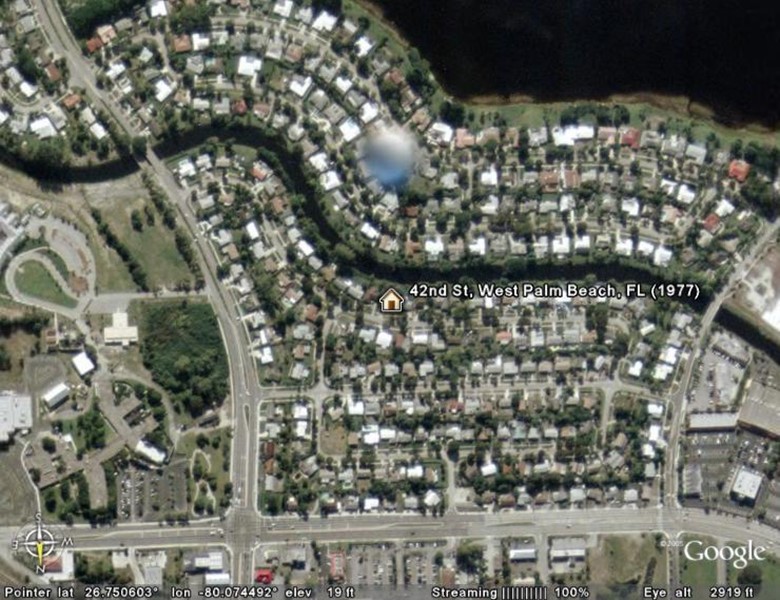
At the end of 1976, my parents moved to West Palm Beach, Florida. I could not take living in Houston any longer, so I decided to follow my family to Florida. In West Palm Beach we lived on a canal on 42nd street. I really loved south Florida! There were alligators in the backyard, there was a Jai-li stadium down the street and I could walk around the corner and buy beer at any time of the day or night. The only problem was I had no job, I was running out of money, and I was driving my mother crazy. So after only four months in paradise, I decided to leave and join the army. Little did I know that while I was gone that my parents would leave Florida and move to California.
This is on the upper northwest side of West Palm Beach facing south. In the upper right of the picture is Lake Magonia. The large bluish ball in the picture is a huge water tower that looms over the area.
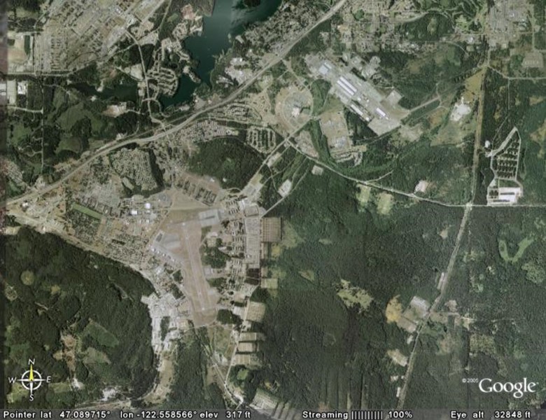
Fort Gordon, Georgia (1977)

In March of 1977, I entered the US Army and was sent to Fort Gordon Georgia for basic training. I spent the spring and early summer of that year there.
Fort Gordon, the training center for the US Army Signal Corps, is just outside of Augusta, Georgia and near the Savannah River. This is a high up aerial photo that shows the entire base and surrounding area. You can clearly see the enormous 1.5-mile parade field that runs through the center of the post.
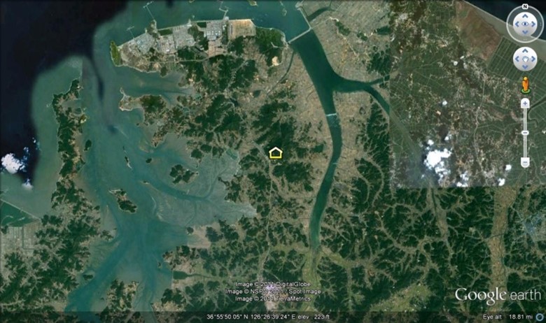
Fort Lewis, Washington (1977-1978)
In the fall of 1977, I drove across the country from South Florida to Washington state making an almost diagonal zigzag across the continental United States. My then destination, Fort Lewis, Washington, is located off I-5 just south of Tacoma and about a 45-minute drive from Seattle. There I was stationed with the 9th Signal Battalion, 9th Infantry Division. We did most of our training in the large green area east of the fort. In March of 1978, we did go down to Fort Irwin, California and spend 28 days training in the desert. That is when I fell in love with southern California and especially the high desert.
This view shows Ft Lewis in the lower left. Interstate-5 runs diagonally from left to right. Steilacoom inlet is just north of Ft Lewis
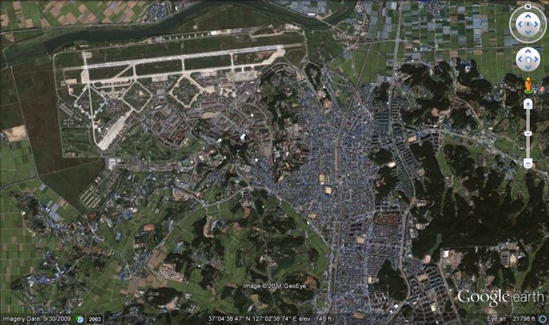
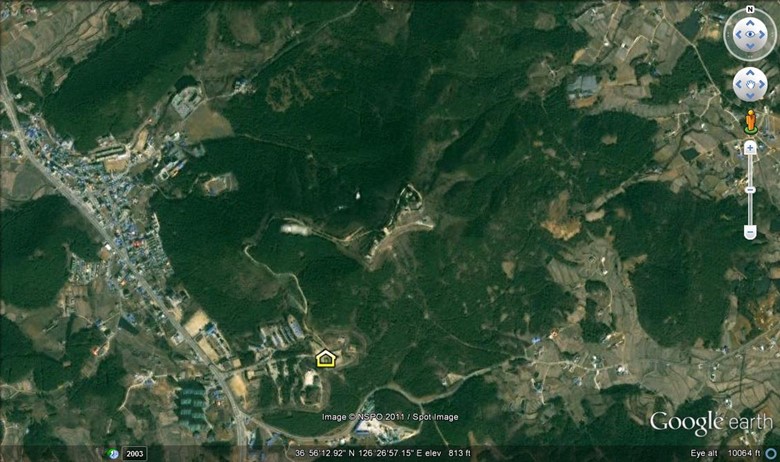
Mangilsan, Korea (1978-1981)
In December of 1978, I was sent to South Korea and after spending about 4 months at Osan airbase south of Seoul I was sent to the Air Defense Command Post at Mangilsan. Mangilsan sits on a finger of a larger peninsula that sticks out from the east-central region of South Korea. There are two photos on this page. The first picture shows Mangilsan mountain (or Manil-san) and the nearby village of Taesan and the second picture shows the same only closer. The first picture shows that Taesan has grown considerably since Susanne and I lived there in 1979. You can see the salt farms that look like dark blue spider webs along the coast. Here the Koreans have built levees that allow the saltwater to flow in and then evaporate to allow the sea salt to be collected and processed. You will notice that the water is so shallow along the coast that you can see the deeper channels below the water. This area has one of the most extreme tidal flux in the world. I believe it is second only to the fiords of Norway.
I find this second picture of Mangilsan to be amazing. This is something that would not have been published in 1979. The white area in the center of Mangilsan mountain is a large radar complex at the top of the mountain (approx. 900 ft above sea level). This facility was at the time operated by the US Air Force & Army and its mission was to watch every aircraft flying over entire Korean peninsula from the tip of Japan to a far north as the Yalu river on the North Korea / Soviet border. I spent many a night from April of 1979 through to the end of 1980 sitting on top of Mangilsan mountain watching the skies above Korea.
From mid-1980 to January 1981, we lived just outside of Osan Air Base in the Songtan-up district of Pyeongtaek City, South Korea, 64 km (40 mi) south of Seoul.