When Google Earth was released in 2005, I thought that it would be interesting to see if I could locate all the places that I lived over the past 50 years (1955-2005). I collected snapshots of satellite pictures of the places that I resided and schools that I attended as kid. Six years later I finally got around to putting it all together in a presentation that documents these shots. In each of the shots the pictures are oriented facing the front of the structure. On most of the pictures there is compass rose showing the orientation of the map.
This covers the first ten years that I lived in the Houston metropolitan area. This was from 1963 to 1973.
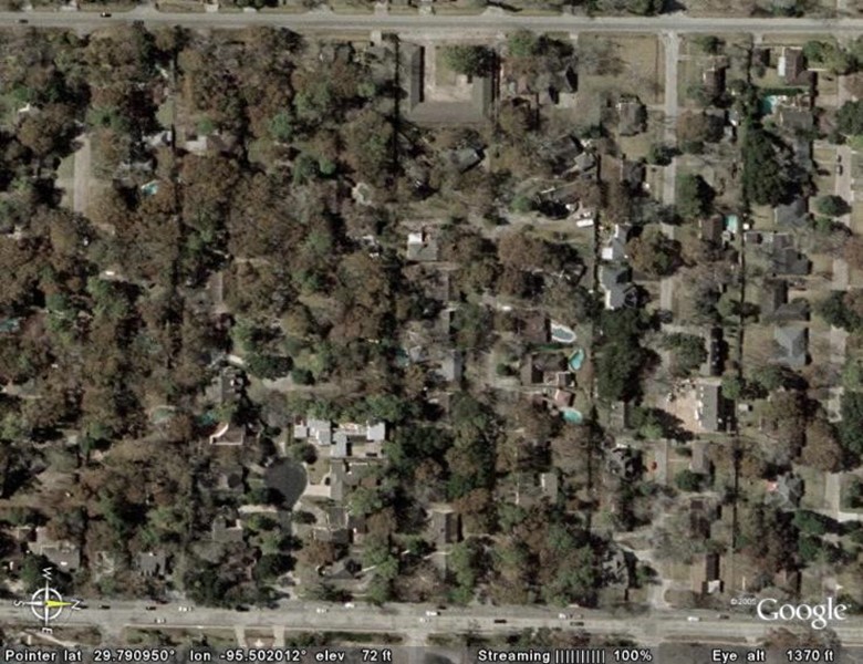
Pech Road., Houston, Texas (1963-1964)
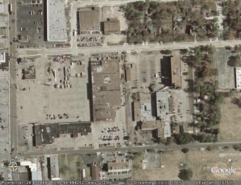
In 1963 we moved to Houston, Texas where my father took a position as the administrator of Sam Houston Memorial Hospital. We lived in a small wood frame house on the grounds of the hospital. When I first looked at this picture, I thought that the house was longer there, but upon closer examination I found that I could see the foundation of the house which appears to have still been there when the picture was taken. The house sat directly behind a K-Mart (larger structure in center of picture).
Pech Road is at the lower part of the picture, Hillendahl Road is in the upper part of the picture and Long Point Blvd is on the left of the picture. On the corner of Hillendahl and Long Point was one of the first Jack-In-The-Box restaurants which appears to still be there. The large building in the center of the picture was a K-Mart in the 1960’s but judging by the lack of cars in the parking lot it may no longer have been a K-Mart when the picture was taken. On the corner of Pech Rd and Long Point is the grave of Mister Hillendahl, the farmer who originally owned all this property. Below this is a second picture that shows the detail of the house’s foundation.
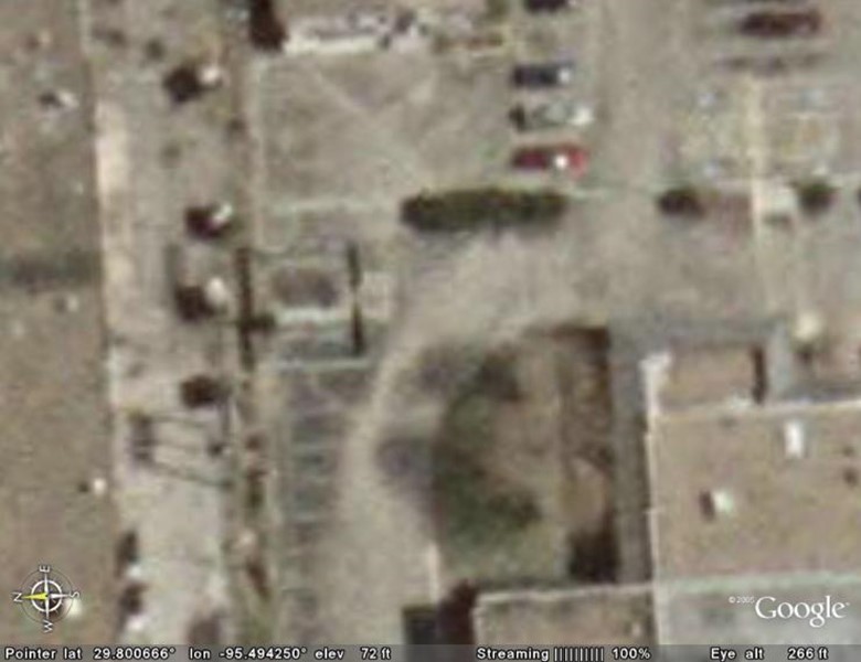
This second picture shows the foundation of the house in the left of center of the picture. Again, hover your mouse over portions of the picture for help in identifying the structures.
Valley Oaks Elementary School (1963-1965)
In the center of the picture is Valley Oaks Elementary where I attended school from 1963 to 1965. The school sits on Westview Dr. To the left of the school is Pech Rd and to the right of the school is Hillendahl Rd. If you follow Pech Rd down to the bottom of the you can see that it ends at a foot bridge that crosses Spring Branch creek. When I was in the fifth grade I was a crossing guard and the best crossing guard assignment was to guard the foot bridge and make sure that no kids messed around over there.
Suburbia Street (1964-1965)
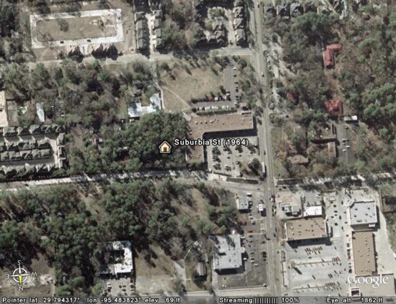
In 1964 my Dad left Sam Houston Hospital to work for St Joseph’s Hospital in downtown Houston. My parents decided to have a house built and while the house on Cedarbrake was being built we lived in this scary little house on a dead-end street called Suburbia. It is hard to tell from this picture, but it appears that the house is no longer there. I remember that when we lived here my favorite television show was The Munsters and I thought that our spooky house in the woods was as scary as Mister Munster’s TV house on Mockingbird lane. Back then Westview Dr (right/left) ended at Wirt Rd (up/down) and on the other side of Wirt was the dead-end street called Suburbia. On the southwest corner of Westview and Wirt was a Unitarian Church (right center). Across Wirt from the church and next to our house was a large wooded lot. The wooded lot now has an L-shaped building on it. Sometime in the 70’s Westview was extended and Suburbia street ceased to exist. The red roofed buildings on the right of the picture were part of a Montessori school next to the Unitarian church.
Cedarbrake Street (1965-1973)
From 1965 to 1973 we lived on Cedarbrake street. In this picture you can barely make out the street because the foliage of the trees hides most of it (Houston is a semi-tropical jungle). In the upper part of the picture is Voss road running left to right and on the bottom of the picture is Bingle road running left to right. Cedarbrake is a dead-end street off on Bingle road that ends in a cul-de-sac and our house was at the end of the cul-de-sac.
In the upper center of the picture is a U-shaped structure. This is an apartment building on Voss road that sat right behind our house. On the right third of the picture you can see Merlin street that runs between Bingle and Voss. Because of the foliage you cannot see Cedarspur street (left third) which enters from Voss but below Cedarspur you can see what appears to be a relatively new black-topped cul-de-sac coming off Bingle. This street was not there in the 1960’s. At the time there was old abandoned farmhouse known as Old Man Bingle’s house. Across Bingle road was a large heavily wooded tract owned by Howard Hughes.
Spring Branch Jr. High School (1966-1969)

This is where I went to school from 1966 to 1969 (6th thru 8th grade). This picture must have been taken in the winter when all the grass in Houston turns brown (California dreaming?). That is Interstate 10 (Katy freeway) on the left. In this picture east is up and west is down. I knew back then that I-10 eventually ended at the pier in Santa Monica, California, and most days back then I would dream of the day when I could just get on that freeway go all the way to Hollywood, California.
Spring Branch High School (1969-1973)
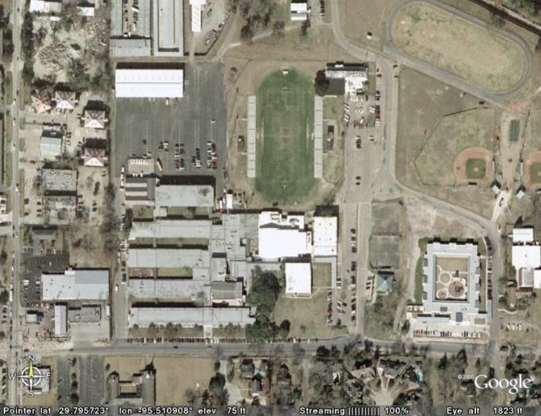
From 1969 to 1973 I went to Spring Branch High School. The school is located on Westview Drive in Houston, Texas. Across Westview is the town of Spring Valley which along with six or seven other little towns is completely surrounded by Houston. In the 1960’s Houston was the largest city in the US in terms of area and not population. It has since been beat out by other cities such as Jacksonville, Florida and Indianapolis, Indiana.
